
Why A level Coastal Fieldwork Matters-investigation questions from North Devon
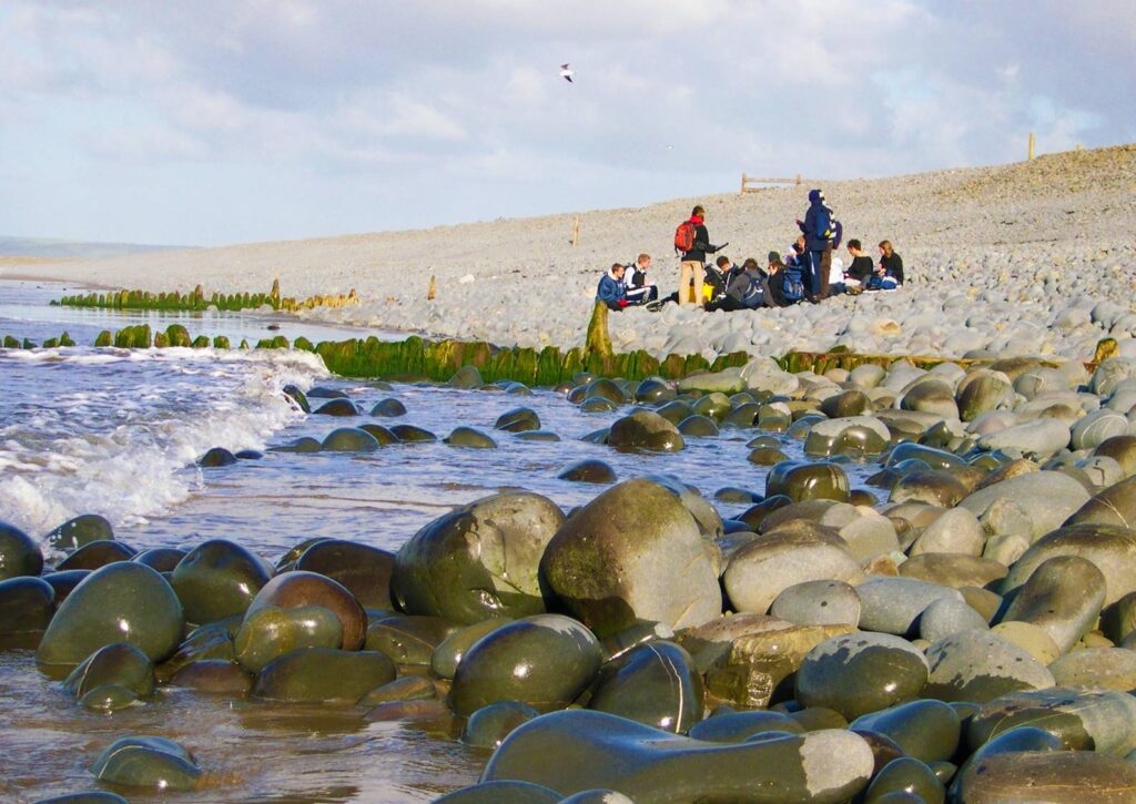
There is something particularly powerful about teaching coastal geography when you are actually on the coast!
Students can learn about hydraulic action, longshore drift, sediment cells and coastal management from a textbook or classroom presentation, but standing on a beach, looking at the sediment beneath their feet, watching the waves approach the shore and trying to explain why a landscape looks the way it does brings a different level of understanding.
Appropriate and relevant fieldwork does not simply provide students with a break from the classroom. It gives them an opportunity to test whether the geographical ideas they have learnt make sense in the real world. This is particularly important at A Level, where students are expected to move beyond describing landscapes and towards explaining, analysing and evaluating geographical processes.
At Skern Adventure in North Devon, we are fortunate to have an extraordinary range of coastal environments including; the depositional landscape of Pebble Ridge, the extensive sand dune system at Braunton Burrows, and the exposed, rocky coastline of Hartland. Students can investigate very different coastal systems without spending hours travelling between sites.
From theory to reality
The AQA A Level specification, for example, describes coastal zones as dynamic environments shaped by the interaction of winds, waves, currents and sediment. It explicitly highlights the importance of observation, measurement, geospatial mapping and data analysis as part of fieldwork. That distinction between learning about geography and doing geography is important.
When studying longshore drift, a student can confidently explain that sediment is transported along a beach by swash moving material up the beach at an angle and backwash returning it perpendicular to the shoreline. They may even be able to draw a beautifully labelled diagram but ask them to stand at Westward Ho! and investigate whether their theoretical model matches the evidence in front of them, and suddenly there are more interesting questions:
- What evidence can we actually collect for sediment movement?
- Does sediment size vary along the beach?
- Is there evidence that the Pebble Ridge has been built and maintained by sediment transport?
- How reliable is a short fieldwork investigation in determining the direction of longshore drift?
These are geographical questions rather than simply questions with geographical answers.
Three example investigations from North Devon
Pebble Ridge: a depositional landscape:
At Westward Ho! students can investigate one of North Devon's most distinctive coastal landforms, the Pebble Ridge. The ridge forms a natural barrier between the beach and Northam Burrows, with the southern section forming a spit where the ridge meets the Taw–Torridge estuary. It provides an excellent opportunity to explore deposition, sediment movement, coastal sediment cells and the relationship between physical processes and human management. This is also a very relevant location for demonstrating that coastal landscapes are dynamic.
Students could measure pebble size and shape at different points, investigate beach profiles, or record wave characteristics. But perhaps more importantly, they can ask:
If the landscape is constantly changing, how confident can we be in the conclusions we draw from one day's data?
That is an excellent A Level conversation. Fieldwork should not hide uncertainty. It should expose students to it.
Hartland: where geology becomes visible:
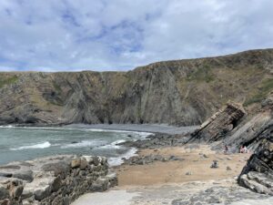
If Pebble Ridge provides an opportunity to investigate deposition, Hartland offers an entirely different coastal story. The Hartland Heritage Coast provides dramatic exposures of resistant rocks, steep cliffs, wave-cut platforms and erosional landforms including caves, arches and bays. It is an ideal environment for exploring the relationship between geology, structure and coastal processes.
For students, this is where the distinction between process and landscape becomes much clearer. Rather than looking at a diagram of a cliff and being told that geology influences erosion, students can examine the rocks themselves.
They can ask:
- Where are weaknesses within the rock?
- How does rock structure influence the coastline?
- Why has erosion produced these particular landforms?
- Can we identify evidence of sub-aerial weathering?
- Why is erosion more apparent in some locations than others?
- and Can we distinguish between what we observe and what we infer? - That is a fundamental geographical skill.
Braunton Burrows: fieldwork doesn't have to mean measuring rocks:
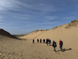
Coastal fieldwork is sometimes imagined as students standing on a beach with a tape measure, but some of the most interesting coastal investigations involve ecosystems and spatial change.
Braunton Burrows provides an excellent setting for investigating sand dune succession and the interaction between biotic and abiotic factors. It is one of the UK's largest sand dune system and forms part of the North Devon UNESCO Biosphere Reserve. The Reserve itself connects land, river and marine environments across North Devon, with Braunton Burrows at its centre. Students can investigate changes in vegetation cover, species diversity, soil characteristics such as pH, moisture and temperature, and dune morphology. This provides a particularly useful opportunity to move from transects and quadrats as techniques to understanding why those techniques are appropriate.
A student might collect a set of quadrat data, but the real geographical question is:
What does this pattern tell us about the relationship between abiotic conditions and vegetation succession?
Again, the emphasis is on interpretation rather than simply collecting numbers.
The value of collecting imperfect data
One of the most valuable things students learn outside the classroom is that fieldwork rarely produces perfect data. Wind affects measurement, waves change, tourists walk through your sampling area, tape measures get tangled, a group member records something in the wrong measurement, and sometimes the pattern you expected simply isn't there. This is not a failure of fieldwork. It is geography in practice!
A Level fieldwork requires students to collect data that is relevant and of good quality, but it also requires them to understand the limitations of their investigation. That makes the fieldwork environment incredibly valuable. Students begin to understand why sampling strategies matter, why replication matters and why conclusions need to be proportional to the evidence.
Fieldwork should generate questions, not just answers
One of the things we emphasise when working with A Level groups at Skern is that the fieldwork should be driven by an enquiry. Rather than “Today we're going to measure beach profiles,” we want students to understand, “We're investigating whether beach morphology changes along this section of coastline, and we need to decide what evidence would allow us to test that.”
We want students to focus on the skills they will need when they eventually undertake their own Independent Investigation:
What should we measure?
Where should we measure it?
How many samples do we need and how do we record them?
What variables might influence our results?
How will we analyse the results afterwards?
Fieldwork provides experience you cannot recreate in a classroom. Students remember places, such as standing on a cliff at Hartland and seeing the waves attack the rock, measuring beach profile while being battered by the wind, the sheer size of Braunton Burrows, and the volume of sediment on the Pebble Ridge. When students later encounter an exam question about sediment cells, coastal systems or dynamic equilibrium, they have somewhere to place that knowledge, the diagram in the textbook becomes a landscape they have physically walked through. Students may even remember coastal traversing at Hartland enabling them to explore rock structure and landscape formation at close proximity, combining the physical experience of the landscape with structured geographical enquiry.
The North Devon has the advantage of one coastline enabling multiple investigations, and the North Devon UNESCO Biosphere Reserve which links upland, river, coastal and marine environments and provide a particularly rich setting for geographical investigations.
At Skern, our A Level field studies courses are designed around exactly this principle. We work with schools to build programmes around their syllabus and learning objectives, whether that means developing core fieldwork skills, collecting data for an NEA, or using contrasting North Devon environments to deepen students' understanding of coastal systems. Our experienced fieldwork tutors can work with schools to develop curriculum-led day visits and residential programmes, from introductory A Level fieldwork skills through to data collection for students' Independent Investigations. For more information or to discuss a fieldwork programme for your students, contact the Skern Adventure team or visit the website https://www.skernadventure.co.uk/field-studies
About the author:
 Daisy Scanes is the Field Studies & Programme Manager at Skern Adventure. She has been delivering geography and environmental courses in North Devon since 2018. She has worked with schools to develop practical fieldwork programmes and support students with geographical enquiry and NEA preparation.