
Lynmouth 1952 Flood Walk
 Introduction
This six kilometre circular walk (with possible extensions) begins through shaded woodland by the banks of the East Lyn River that carried the bulk of the flood waters in the 1952 flood disaster that hit the village of Lynmouth on the north Devon coast. With a death toll of 34, it remains the worst flood disaster in England’s history.
The walk has a wonderful tea room at its halfway point, and a suggested extension passes a great pub before continuing along a stunning section of the South West Coast path along steep cliffs.
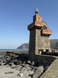
The route finishes in the village of Lynmouth to examine evidence of the 1952 flood and the management that has taken place since then to mitigate future disasters.
Download the PDF below for further details and a map.
About the Author
 Paul Berry
Author / Field Studies Tutor
Paul is a former Head of Geography and Assistant Vice-Principal. Paul took early retirement after 35 years as a Geography Teacher, and has written GCSE exam revision books for Collins, Hodder, and BBC Bitesize. He currently works as a Field Studies Tutor in Iceland for education travel company Rayburn Tours.
Contribute
Our aim is to promote geography and geographical education in the South West of England. Geography SW is a collaborative project driven by a group of enthusiastic geographers who have volunteered their time to create a wide-ranging and dynamic resource to support the wider geographical community.